

Features Tasmania Offline Topo map
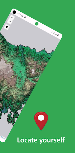
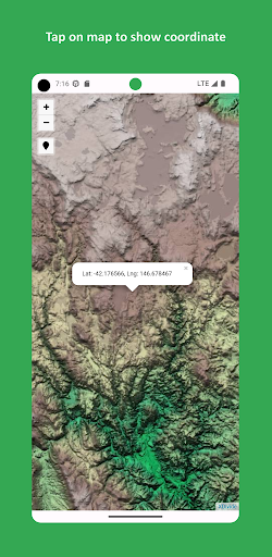
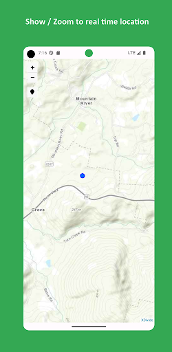
Designed with simplicity in mind, this app offers an intuitive user interface that enables you to quickly and easily find information about surroundings, without any prior technical knowledge or experience.The app offers offline topographic map of Tasmania, meticulously provided and maintained by Geoscience Australia.
The acquisition of the individual LiDAR surveys and derivation of this product has been part of a long-term collaboration between Geoscience Australia, the Cooperative Research Centre for Spatial Information (CRCSI), the Departments of Climate Change and Environment, State and Territory jurisdictions, Local Government and the Murray Darling Basin Authority under the auspices of the National Elevation Data Framework and Coastal and Urban DEM Program.
The source datasets have been captured to standards that are generally consistent with the Australian ICSM LiDAR Acquisition Specifications with require a fundamental vertical accuracy of at least 0.30m (95% confidence) and horizontal accuracy of at least 0.80m (95% confidence).As a testament to our commitment to utilizing cutting-edge technology, we proudly leverage the Leaflet JavaScript library – a project born in Ukraine.
It delivers a seamless user experience that empowers you to explore and discover the world with ease.This app is the embodiment of our unwavering commitment to making the world a better place, and we are honored to provide a powerful platform that equips you with the tools and information needed to navigate and explore the surroundings with confidence and clarity.Get ready for an adventure unlike any other, where finding your way is effortless and worry-free.
Secure & Private
Your data is protected with industry-leading security protocols.
24/7 Support
Our dedicated support team is always ready to help you.
Personalization
Customize the app to match your preferences and workflow.
See the Tasmania Offline Topo map in Action
Get the App Today
Available for Android 8.0 and above